Institute of Marine Geology and Geophysics
Far Eastern Branch
Russian Academy of Sciences

The Institute of marine Geology and Geophysics of the far Eastern branch of the Russian Academy of Sciences was established by the order of the Council of Ministers of the USSR dated 23.06.1946 № 7930 as the Sakhalin research base of the USSR Academy of Sciences. 6.10.1949 the base was reorganized into the Sakhalin branch of the USSR Academy of Sciences.
20.05.1955, branch reorganized into the Sakhalin complex scientific research Institute, USSR Academy of Sciences (SakhKNII).
25.10.1984 was renamed the Institute of marine Geology and Geophysics of the far Eastern scientific center of the USSR Academy of Sciences (from 26.09.1987 of the far Eastern branch of the USSR Academy of Sciences).
13.12.2011 the type and name were changed to Federal state budgetary institution of science Institute of marine Geology and Geophysics of the far Eastern branch of the Russian Academy of Sciences (IMGG FEB RAS).
Currently, the Institute is subordinated to the Ministry of science and higher education of the Russian Federation, https://minobrnauki.gov.ru/
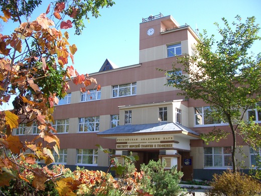
Legal and actual address of the Institute: 693022, Russia, Yuzhno-Sakhalinsk, Nauki str., 1B Contact details and the location map are given on the page http://www.imgg.ru/ru/contact
Director of the Institute: doctor of physical and mathematical Sciences Leonid Bogomolov, http://www.imgg.ru/ru/users/leonid-bogomolov
The purpose and subject of the Institute is to perform fundamental, exploratory and applied research in the field of Geology, Geophysics and Geoecology, aimed at the study of natural and man-made catastrophic phenomena and problems of environmental management.
IMGG FEBRAS, in accordance with its Statute, carries out publishing activities. Annually 3-4 monographs are published, http://books.imgg.ru/index.htm ; the scientific journal “Geosystems of Transition Zones” is published http://journal.imgg.ru/
The Institute includes: 7 scientific laboratories, post-graduate Department, center for collective use. The actual number of personnel (as of 31.12.2018) is 120 people, including 64 researchers (including 1 corresponding member of RAS, 7 doctors and 32 candidates of Sciences). The average age of the researchers of IMGG FEB RAS is less than 50 years currently. The Institute has 9 candidates of Sciences under the age of 35 years.
The funds of IMGG FEB RAS contain scientific collections of samples of natural objects, mainly collected on Sakhalin and the Kuril Islands: minerals, cuttings of wood plants of Sakhalin and the Kuril Islands, vascular plants, mosses and lichens, Zoological collection.
The joint dissertation Council D999.004.03 works on the basis of the Institute for searching degrees of doctor and candidate of Sciences, on specialties: 25.00.10 – Geophysics, geophysical methods of mineral prospecting (physical and mathematical Sciences), 25.00.29 – Physics of the atmosphere and hydrosphere (physical and mathematical Sciences), http://www.imgg.ru/ru/teams/dissertation-council
Achievements of the Institute, the most important results:
1. For the first time in the world, an official state regulatory standard for tsunami accounting was created - a Set of rules "Buildings and structures in tsunami-prone areas. Rules of design", aimed at application in the design of new and reconstruction of operated coastal and coastal buildings and structures located in tsunami-hazardous areas of the Russian Federation. Set of rules was developed in order to ensure specified reliability and security, the impact of the tsunami, as well as in the development of projects of territorial planning, the evaluation of the effects of probable tsunamis and analysis of tsunami risk. A theoretical basis for the probabilistic model of Poisson-type tsunami recurrence is created. We have identified the structure function of the frequency of occurrence of the heights of tsunami General view. Conclusions are made about the nature of its asymptotics for small and large tsunami heights. Survey maps of tsunami hazards zoning for a number of coasts of the Russian Far East are built.
2. The new directions of Oceanographic research are opened: sea swell under the ice and chaotic oscillations in dynamic marine systems. Previously unknown effects of generation and propagation of dangerous sea waves were revealed. The effect of generation of low-frequency microseisms (with periods of about 50 and 100 s) by infra-gravitational waves, which presumably affects the processes of accumulation/removal of stresses in the earth's crust, was found and investigated. Peaks at close periods were observed during storms in two different areas of the South-Eastern coast of Sakhalin island in different years, which suggests a reliable allocation of this effect. The identity of the peaks is presumably due to the similar nature of the coastal relief of the coast.
3. A high-precision geodetic basis for geodynamic studies in the zone of convergence of the Eurasian, North American and Pacific tectonic plates has been created. The spatial position of their boundaries is studied, the depth of contact and the rate of convergence on Sakhalin island are estimated. Unique data on modern geodynamic processes in the Kuril subduction zone are obtained. The seismic potential of different parts of the subduction zone is estimated. Continuous GPS/GLONASS measurements in the epicentral zone of Simushir earthquakes of 2006 has revealed the dependence of the asthenosphere viscosity on the speed of the observed post-seismic motion of the earth's surface. GPS/GLONASS stations of the Okhotsk region registered coseismic displacements of the earth's surface as a result of the Okhotsk earthquake of 24.05.2013 MW=8.3, which occurred near the West coast of the Kamchatka Peninsula at a depth of ~600 km. A dislocation model of a deep-focus earthquake in an elastic half-space is constructed, which describes the type of in the source-site – normal, shallow, with Western fall of 11 degrees angle, and with a maximum displacement of 7 m. The subducting Pacific plate was broken by 50 km by thickness.
4. A unified concept for the development of instrumental seismological observations in the Far Eastern region of Russia has been developed. On the basis of the identified features of seismicity and the deep structure of individual blocks of the region, new refined hodographs of the P and SP waves were compiled, introduced since 2006 into the practice of processing observations of the Sakhalin branch of the United Geophysical Service of the Russian Academy of Sciences. An effective methodology and mathematical support for the medium-term forecast of strong earthquakes in the northwestern Pacific Ocean along the seismicity stream, based on the stable laws of the seismic regime, has been created. A two-stage method for detecting the final stage of preparation of a strong (M≥5) earthquake in the Sakhalin region and predicting the moment of its occurrence is proposed. The developed methodologies were used in the development of forecast conclusions about the seismic situation in the Kuril and Sakhalin regions. Prospect development has been confirmed by successful predictions of the number of earthquakes: Shikotanskoe 1994 (Mw=8.3), Tokachi-Oki 2003 (Mw=8.3), Takoe 2001 (M=5.6), Nevelsk, 2007 (Mw=6.2), Obnorskoe 2016 (Mw=5.8).
5. The methodology and software for the calculation of maps of peak accelerations of soil and their variation coefficients for different periods of earthquake recurrence, as well as maps of pseudo-spectral accelerations of soil on the basis of probabilistic analysis of seismic hazard using the logical tree method are developed. On the basis of this methodology, a detailed seismic zoning of the territories of more than 20 settlements of the Sakhalin region, as well as areas of construction of oil and gas infrastructure projects "Sakhalin-1", "Sakhalin-2" and "Sakhalin-5"was carried out. Clarification of the background seismicity of the territory in the vicinity of the Sakhalin GRES-2 construction (North of Ilyinsky village, Sakhalin island) was carried out. During the decoding of aerial photographs of the study area, five previously unknown active faults located outside the survey area were found. Maps of detailed seismic zoning in the parameters of macroseismic intensity of concussions (IMSK) and peak acceleration of soil (PGA, g) for the periods of repeatability of 500, 1000 and 5000 years have been developed . Evaluation IMSK on the cards JEM in a Central location surveys for medium soil II was lower in comparison with OSR-97 0.4 (map A), 1.0 (C) 0.3 and (C) points.
6. On the example of seismicity of two regions (China and the North-Western part of the Pacific seismic belt), the presence of a connection between two natural phenomena – strong earthquakes and jet streams in the atmosphere is established. A joint analysis of both types of data for the observation period 2006-2010 showed that the ends of the front or tail of jet groups retain their position for 6 or more hours in the vicinity of the epicenters of strong (M > 6.0) earthquakes, anticipating such events for a period of several days to two months.
7. Tectonophysical reconstruction of the tectonic pressure field has been made for the Pacific Northwest flank of the seismic focal zone in the area of preparation of the Tohoku earthquake, 2011 Axis oceanic trenches sharply separates the upper part of the tectonosphere two geodynamic regime: sub-horizontal compression to the West of the trench axis and subhorizontal stretching to the East of the trench axis. It has been found that the development of the source occurred in the area of articulation of areas of the crust with high and low levels of effective pressure. The parameters of the current stress state of the earth's crust and the upper mantle in the southern Kuril Islands before and after the Shikotan earthquake of October 4(5), 1994 have been reconstructed. In most of the study area the values of the stress tensor parameters have a stable character, the predominant geodynamic regime is horizontal compression, the main type of the moment tensor is shift. The change in the nature of the stress field is mainly observed in the contacting zone of the Japanese and Kuril-Kamchatka seismofocal regions.
8. The compiled data on the practical application of ground stations and seismographs in the seismic and seismological experiments are genelalized firstly in 50 years, to study the velocity structures of the crust and underlying mantle on the bed of the North-Western Pacific ocean and its marginal seas, as well as the fine structure of the seismic focal zones of the Benioff and Tarakanov. These data, which are of paramount importance for decoding tectonics, geodynamics, magmatism and geothermal regime of the North-Western part of the Pacific region, cannot be obtained by other geophysical methods (NHS, KMP, MOGT, NSP, etc.).
9. Petrochemical composition of igneous rocks in the sea of Okhotsk collisional suture (40-70х1200 km) is installed. It is composed of serpentinite melange, including blocks of the ocean plate, Jurassic-Paleogene basalts which were formed in the spreading zones (MORB), in the ocean intraplate (WPB), island-arc and marginal-marine (IAB) environments, and continental basalts – in continental rift, island-arc and trap environments. In modern times, this collision seam is transformed into a mantle-cow shear zone separating the Okhotsk and Amur tectonic plates. The formation of the folded-block structure of the Western Sakhalin terrain is completed in Quaternary time. North-Eastern compression in the Eocene-Pliocene caused right-hand displacements along the terrane-limiting submeridional faults, which caused dislocations of adjacent sediments, similar to dislocations near fault zones, which periodically occurred in the Cenozoic in the rift stages of formation of oil and gas sedimentary basins of Sakhalin island and its shelf.
10. Based on satellite data and video surveillance, a comprehensive analysis of volcanic activity in the Kuril Islands for 2017 has been carried out. The main parameters of the eruptive event associated with volcanoes Ebeko (island Paramushir), Chirinkotan (O. Chirinkotan), Sarychev Peak (Matua island) and Curly (Iturup island) have been identified. Recommendations on the use of remote sensing for the detection of thermal anomalies as precursors of volcanic eruptions and the dynamics of ash cloud propagation are given. The results of the monitoring by the SVERT group have been transmitted on-line to the Sakhalin region Emergency Agency and to the international Advisory centers on volcanic ash clouds. It was found according to the satellite monitoring hat in the years 2013-2016 two episodes of explosive activity of Ushishir volcano occurred. The use of the VolSatView service has significantly expanded the possibilities for the detection of thermal anomalies and the identification of ash emissions, which has significantly improved the efficiency and quality of monitoring of volcanic activity in the Kuril Islands and Kamchatka.11. The mechanisms of erosion of banks with excess sediment in the beach area (which is a natural wave-damping system) have been considered at first. The main regularities of the spatial structure of the destruction of the shores of North-Eastern Sakhalin determine the phenomena of rhythm in the manifestation of erosion processes. Erosion rhythms of wavelength of 1.3, 2.0, 4.0, 5.6, 8.5, 11.6, 25.6, 64 km are established, the mechanisms of their occurrence are specified. The fallacy of the notions is argued that the cessation of active morpholithodynamics phase of development of the coastal zone in the transition of average daily temperatures in the freezing mark occurs. The deterioration of the beach wave-absorbing properties (drainage and roughness) during freezing (before the formation of solder or ice) is one of the most significant factors of relief formation on the shores of tidal subarctic seas, the height of the splash marks increases by 30-45%).
12. The 32 new species of lichens, including Physcia dimidiata (Arnold) Nyl, have been identified for the flora of mosses and lichens of Sakhalin island, this is newfor the Russian Far East. On Kunashir thermal springs of Golovnin volcano and Stolbovskikh thermal springs found two new for the island moss species Meesia triquetra Angstr. and Stereodon plumaeformis Mitt. For three rare mosses (Sphagnum fallax H. Klinggr., S. fimbriatum Wilson, S. palustre L.) revealed new places of their growth.
